-
Portable Drone Remote ID Receiver Boosting Situational Awareness
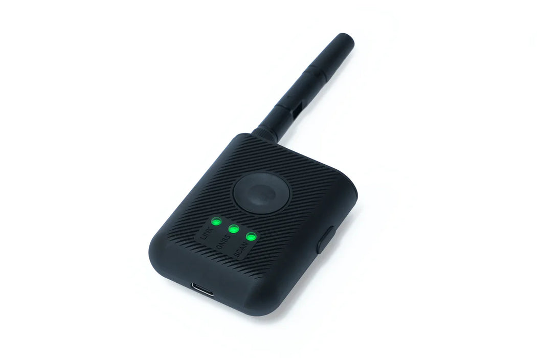
A compact, wireless, battery-powered Remote ID receiver, designed for public safety organizations and professional pilots.
Please call to check stock eta.Key Features
- Remote ID Receiver: Device that detects all drones equipped with Remote ID technology.
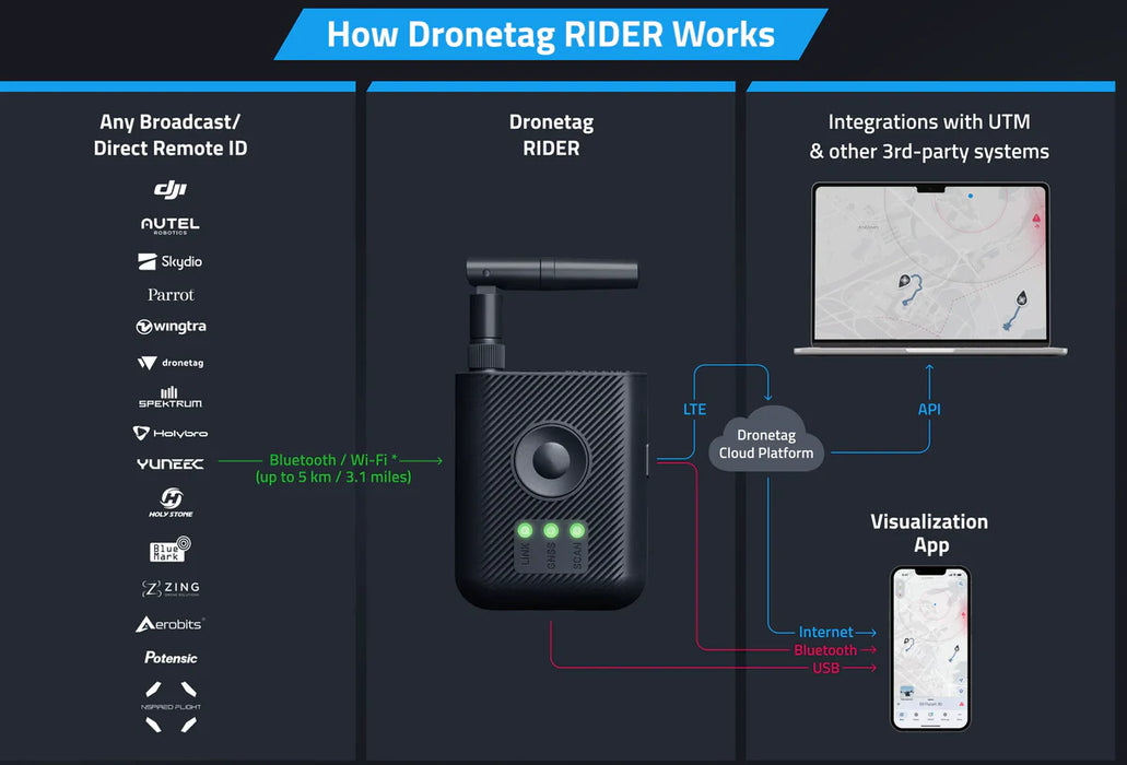
- Drone Agnostic: Captures Remote ID data from drones such as DJI, Autel, Skydio to up to 3 miles (5 km).
- Instant Alerts: Stay informed with real-time drone activity notifications via built-in sound alerts and LED indicators.
- 10 Hours Battery Life: Runs up to 10 hours on a single charge — or power it up via USB-C for continuous 24/7 operation.
-
Multi-platform App: View real-time and historical drone detections in multiplatform web for iOS, Android and Web.
-
Multiple Options for Data Transmitting
RIDER has three choices for real-time data sharing: via integrated LTE, Bluetooth, or USB-C, allowing online or offline data transfer for private/sensitive operations.Designed for Any Setup: Small, Versatile, Effortless
RIDER combines a compact, versatile design with robust buttons and a foldable antenna for easy installation and reliable signal reception. No matter where you place it, RIDER adapts seamlessly to your needs, keeping you informed of nearby drone activity.Cross-platform App for Airspace Overview
Monitor drone activities via the Dronetag App or seamlessly integrate with third-party UTM and C-UAS systems using our API. The RIDER provides drone detection, pilot identification, and even drone manufacturer and model recognition.Situational Awareness
Gain Situational Awareness in Any Environment
Gain advanced situational awareness of drone activity in any airspace using a wearable Remote ID receiver Dronetag RIDER. Precise, reliable and drone-agnostic technology instantly alerts users of activity and transmits telemetry drone data directly to the Dronetag app or UTM / C-UAS system of choice.Drone Detection
Control Assets with Drone Detection and Whitelisting
Visualize, map and manage drones or an airspace in real time within a vast radius using the Dronetag platform. Capture details such as drone location, altitude and pilot information to easily track and maintain operational control of an airspace or fleet.Quality Design
Functional, Quality Design for the Entire Industry
Designed with pilots, operators and a multitude of use cases in mind all solutions are compact, utilitarian and extremely easy to use. Our future-proof offering is durable enough for use by the defense sector and public safety units yet intuitively designed for businesses and hobbyists with a range of skill sets. Straightforward UX makes Dronetag the solution of choice for seamless, hassle-free flight across the entire industry.